Research

Research

Research on North Africa, infrastructure, mobility, sovereignty, and postcolonial state-building, with Morocco and Western Sahara at the center.

My work combines archival research, fieldwork, digital mapping, historical datasets, and public-facing interpretation to study how roads, airlines, images, and state institutions made political authority visible and durable.

Research agenda

These projects ask how mobility systems, visual evidence, and state institutions turned claims into routines: roads that made territorial control durable, airlines that made sovereignty operational, and truth-commission archives that shaped the public limits of accountability.

  • Infrastructure & sovereignty
  • Archives & visual evidence
  • Digital mapping & datasets
  • Fieldwork & language study

Evidence base

Archives, fieldwork, and datasets

The research is organized around inspectable materials: archival sites, field observation, reconstructed datasets, and visual sources.

Mohammed VI Library at Al Akhawayn University in Ifrane, Morocco, an archival research base for Reese Hollister's Fulbright fieldwork.
Archives: Mohammed VI Library, Al Akhawayn University, Ifrane.
Layered cliffs of Wadi Ghul at Jebel Shams, Oman, photographed during Arabic language study and comparative fieldwork.
Field/language context: Jebel Shams and Wadi Ghul, Oman.
Atlas panel from the From Colonies to Carriers project showing African countries shaded by national airline count.
Dataset work: postcolonial African airline atlas panel.

Research clusters

Three lines of inquiry

Mobility after empire

How did newly independent African states use civil aviation, roads, and transport networks to build postcolonial sovereignty — and how did those infrastructure choices constrain and enable what came after? This cluster centers the From Colonies to Carriers dataset and the Western Sahara highway research.

Infrastructure and sovereignty

Territory is not a given — it is made durable through infrastructure, administration, and repeated material presence. This cluster asks how roads, buildings, and state facilities turn contested claims into routine facts on the ground, with a focus on the Western Sahara conflict and Moroccan state-building after 1975.

Memory, justice, and state legitimacy

Truth commissions, political prisons, and transitional justice archives — how do states manage the memory of political violence, and what does the management of that memory reveal about the limits of accountability? This cluster centers the Tazmamart research and the Equity and Reconciliation Commission.

How the research works

Research process

Each project moves through the same sequence — a question, an archive, a dataset, a map, an argument, and a public output. The steps look like a pipeline, but in practice they loop back on each other.

  1. Question Start with a historical puzzle — something that does not fit the standard account.
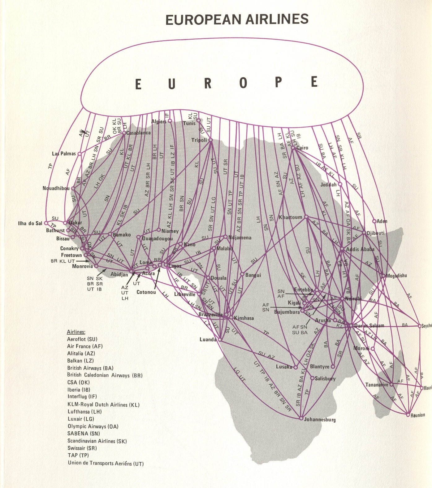
    The question has to be specific enough to answer with evidence and consequential enough to matter. For the airlines project: why did newly independent states invest in national airlines immediately after independence, even when they could not afford them? For Western Sahara: can road infrastructure serve as a proxy for measuring territorial consolidation over time?
  2. Archive Find where the evidence lives — documents, images, data, field observation.
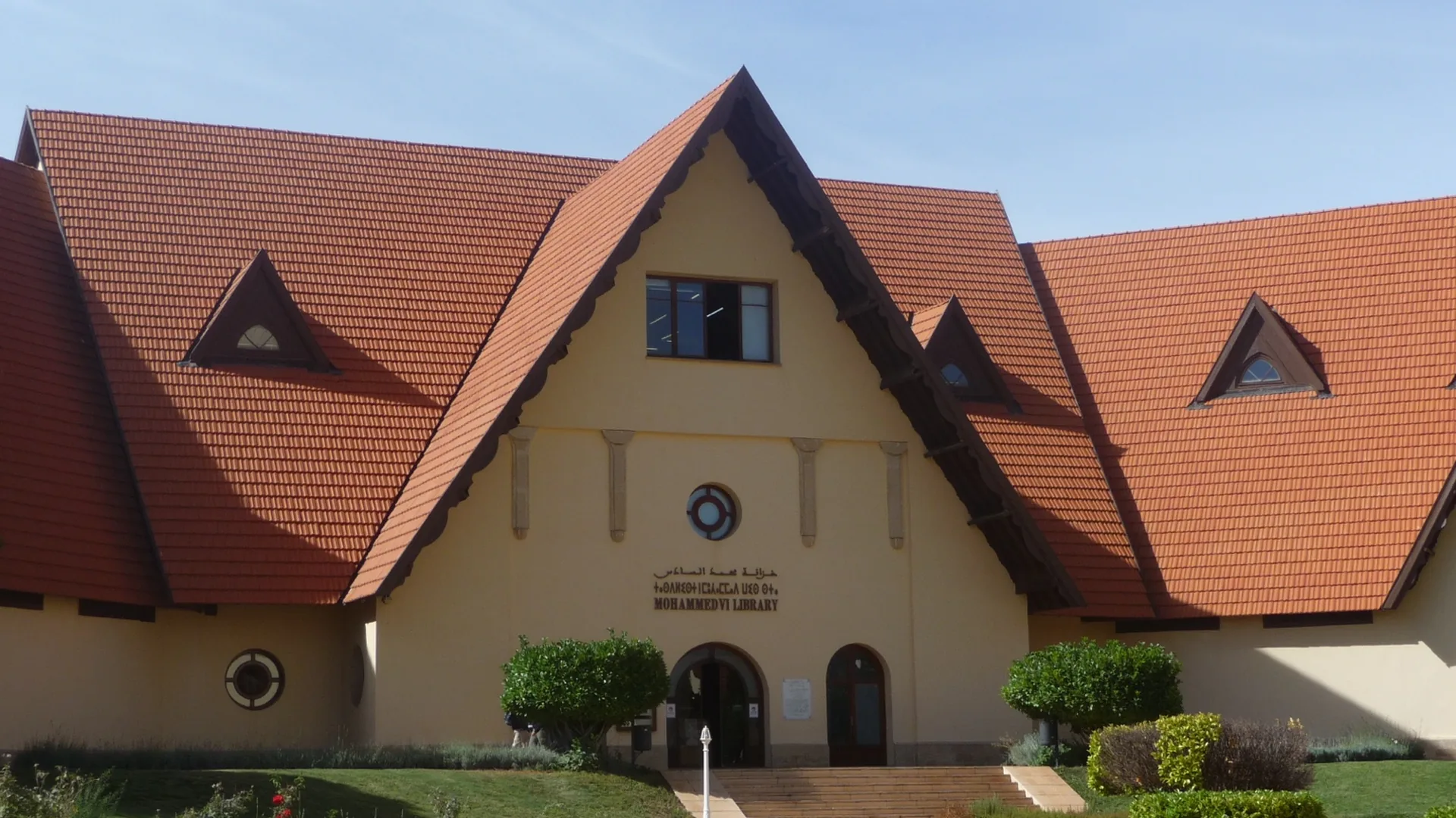
    Archives can be paper (the Mohammed VI Library at AUI, the National Archives of Morocco), digital (airline route databases, ICAO records, OpenStreetMap history), or field-based (on-the-ground observation and interview notes from Morocco and Oman). Knowing the archive's gaps matters as much as knowing its contents.
  3. Dataset Build structured data where the archive is fragmented or comparative.
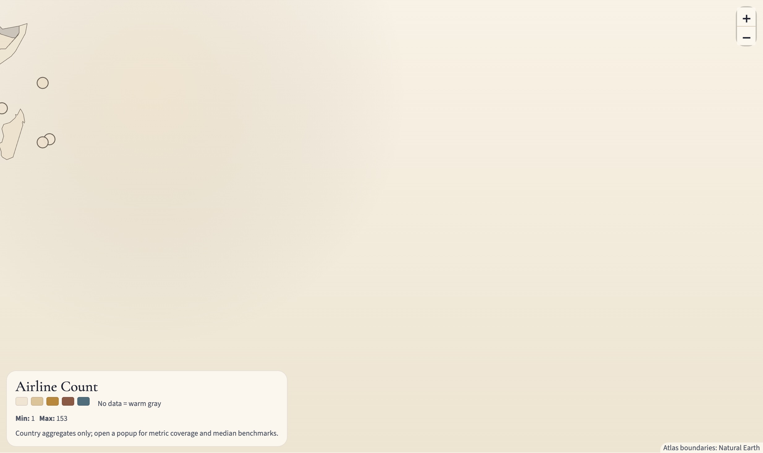
    Some questions require reconstructing evidence from scratch. The African airlines dataset combines ICAO records, airline histories, Wikipedia entries, and regional databases into a unified 723-airline, 54-country spreadsheet. The Western Sahara road data required pulling OpenStreetMap history through the ohsome API and computing year-by-year road stock for each territory from 2008 to 2025.
  4. Map Visualize the spatial and temporal structure of the evidence.
    Mapping is both analytical and communicative. It reveals patterns invisible in tables — the geographic clustering of airline founding dates, the directional expansion of road networks from north to south across Western Sahara — and makes those patterns legible to audiences who have not read the underlying data.
  5. Argument Build the historical claim that the evidence supports.
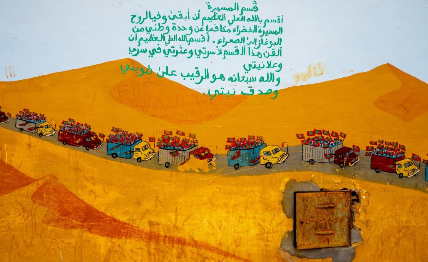
    The argument connects the empirical pattern to a broader historical or political interpretation. Airlines were not just transportation infrastructure — they were sovereignty performances, proof to the world and to domestic audiences that the new state was real and operational. Western Sahara roads are not just roads — they are territorial infrastructure, making Moroccan administrative presence materially durable in a contested zone.
  6. Public Output Make the argument accessible without dumbing it down.
    Public outputs include conference papers, slide decks, interactive databases, Substack posts, and YouTube videos. The goal is for the research to reach people who can use it: other historians, journalists, policymakers, and anyone curious about North Africa and postcolonial state-building. The interactive African Airlines encyclopedia is the fullest expression of this — 723 airlines in a searchable, mappable, downloadable format.

Projects

Research projects

The strongest research surfaces on the site.

Historic route map showing European airline connections across Africa.

From Colonies to Carriers

Digital History / Research

Dataset and digital history project tracing how newly independent African states used national airlines and route networks to make sovereignty operational — with Royal Air Maroc as the close case.

  • Deck
  • Paper
  • Dataset
  • Map
A mural in Sidi Ifni depicting the 1975 Green March — a procession of trucks and marchers beneath the Arabic oath of the march.

Western Sahara Highways

Research / Public Scholarship

Research on how highways, logistics corridors, and territorial administration helped Morocco convert claims over Western Sahara into durable control.

  • Deck
  • Map
  • Timeline
  • Roads
Title slide for Truth After Tazmamart: Lawfulness in Morocco's Equality and Reconciliation Commission.

Truth After Tazmamart

Research / Public Scholarship

Research on Tazmamart, Morocco's Equity and Reconciliation Commission, and the political limits of truth-seeking when accountability remains constrained.

  • Deck
  • Paper
  • Justice
The Sahara dunes near Merzouga, Morocco — sweeping sand ridges with camels at the base, a landscape tied to mobility and fieldwork.

Fulbright Morocco

Research / Teaching & Learning / Public Scholarship

Fieldwork and language-study archive from a Fulbright year in Morocco — connecting archival research practice, Arabic and Darija study, and public historical interpretation.

  • Fieldwork
  • Arabic
  • Teaching

Publications

Published writing & research archive

Earlier undergraduate research and public-facing history writing, kept as a compact archive behind the current project work.

Presentations

Conference talks & presentations

Selected talks delivered at academic conferences and graduate research events.