Project

How Highways Decided Morocco's Victory in the Western Sahara Conflict

A capstone argument tracing how infrastructure build-out helped make later sovereignty claims and diplomatic normalization more plausible.
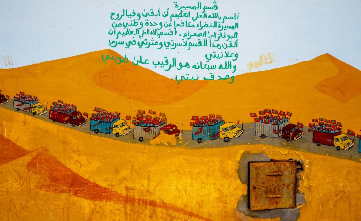
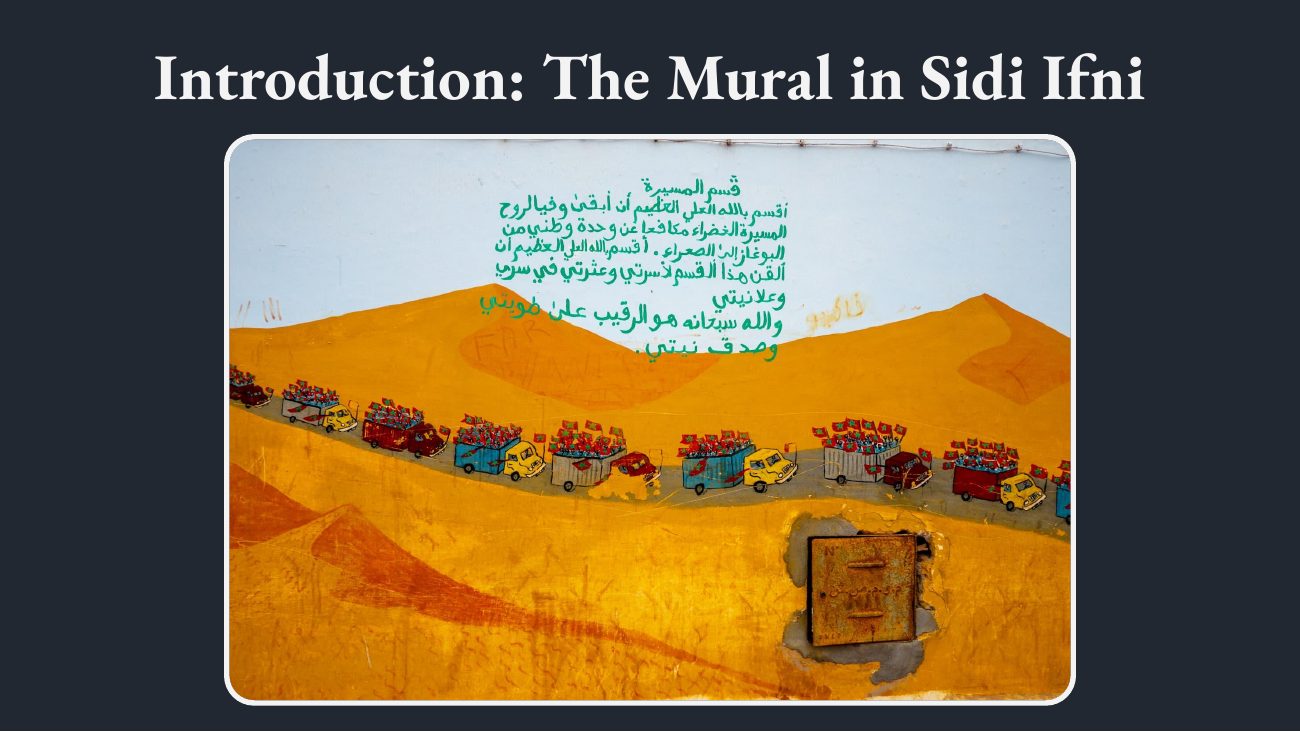
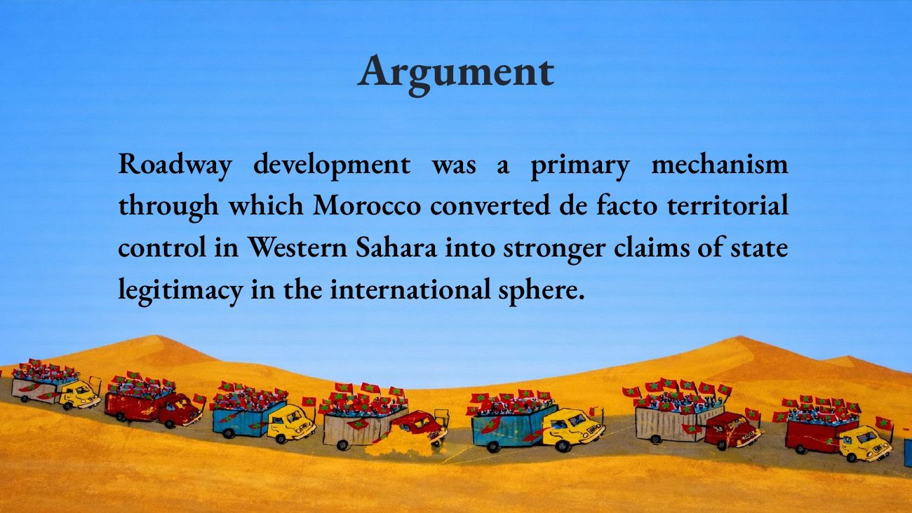
A mural in Sidi Ifni depicting the 1975 Green March — a procession of trucks and marchers beneath the Arabic oath of the march.View detail ↗
A street mural in Sidi Ifni memorializing the Green March of 1975 — the founding event of Morocco's claim to the Western Sahara.
My role, areas & skills
  • Role

    Historical researcher, source synthesist, and data / visual workflow builder

  • Areas

    Research / Public Scholarship

  • Skills

    Historical research, Process tracing, Visual evidence design, Data analysis, International studies

The objective

Explain how highways and logistics corridors shaped Moroccan control and sovereignty claims in Western Sahara.

What I did

  • Connected infrastructure evidence to a historical and political argument.
  • Organized road development, territorial administration, and recognition into timelines and maps.

Deliverables

  • Graduate capstone paper and presentation deck.
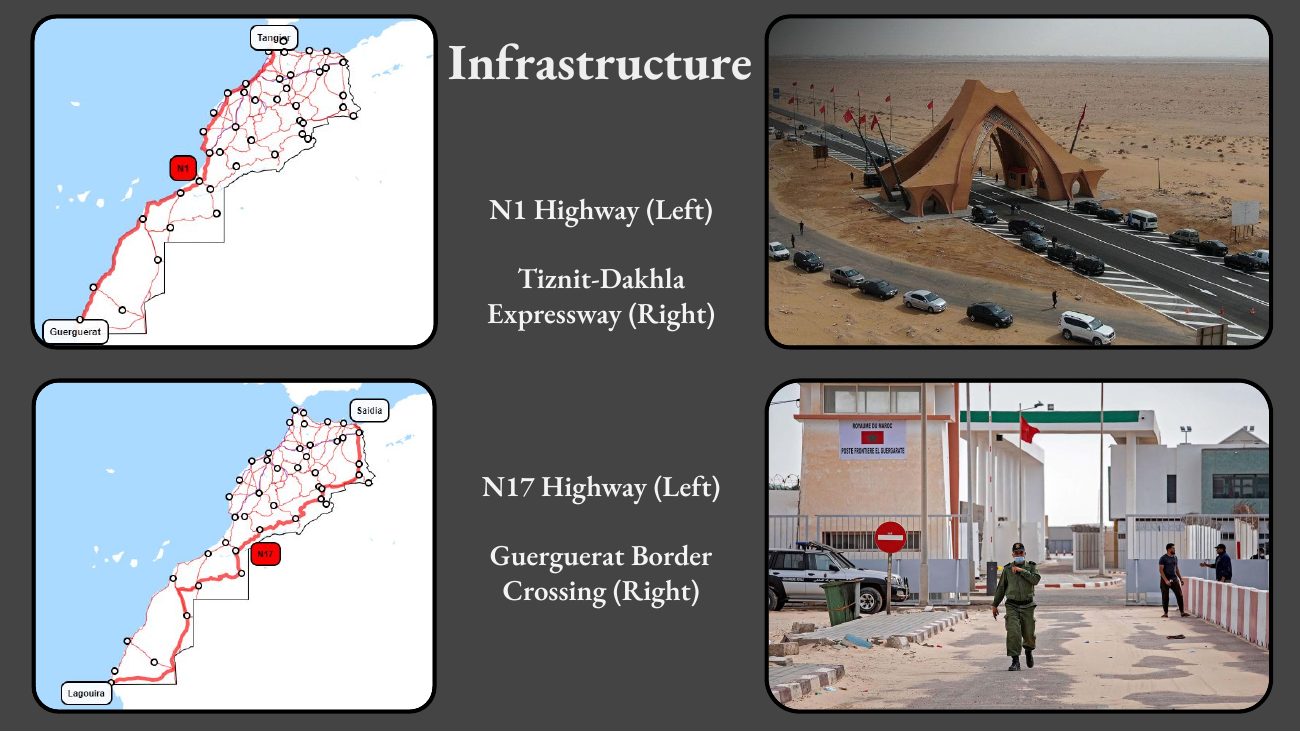
  • Highway route map, dual timeline, and roads-over-time evidence.

Result

Completed a graduate capstone with a reusable visual evidence set for explaining the relationship between infrastructure and sovereignty.

The deck

Capstone presentation — NC State Graduate History Conference, April 2026

Download the full deck (PDF) →
Use the controls to browse 22 slides. Select an image for a larger view, or open the PDF.

Read extracted slide text

Text extracted from the original PDF. Image-only slides and visual relationships are not fully represented here; consult the slide image and the written project narrative.

Slide 1

How Highways Decided Morocco’s Victory in the Western Sahara Conflict Reese Hollister - Master of International Studies (MIS), SPIA 2026 North Carolina State History Graduate Student Association Conference Advisors: Dr. Kristen Alff and Dr. Robert Reardon 11 April 2026

Slide 2

Introduction: The Mural in Sidi Ifni

Slide 3

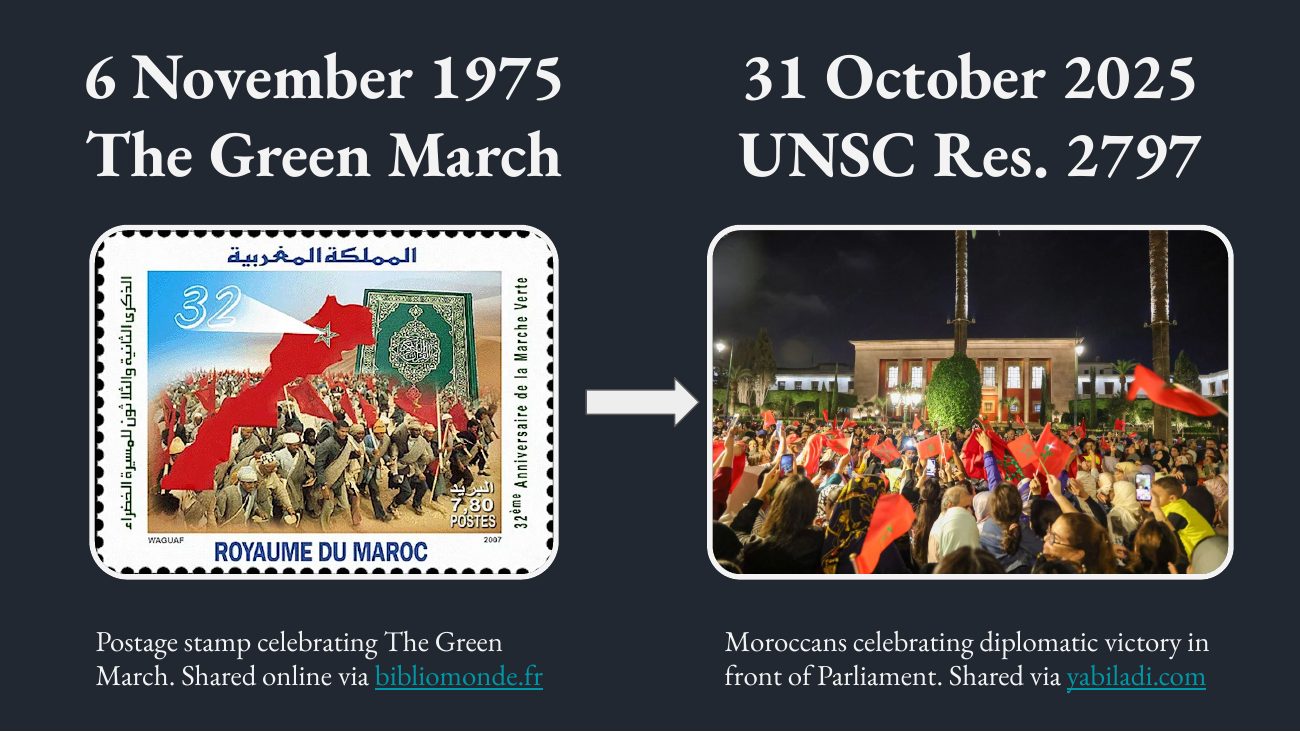
6 November 1975 31 October 2025 The Green March UNSC Res. 2797 Postage stamp celebrating The Green Moroccans celebrating diplomatic victory in March. Shared online via bibliomonde.fr front of Parliament. Shared via yabiladi.com

Slide 4

This slide contains an image or diagram without extractable text. Open its full-size image above.

Slide 5

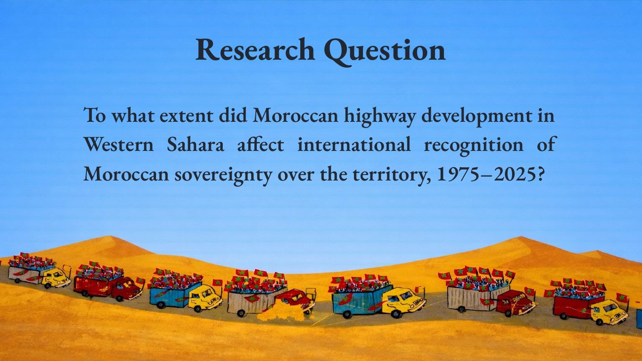
Research Question To what extent did Moroccan highway development in Western Sahara affect international recognition of Moroccan sovereignty over the territory, 1975–2025?

Slide 6

Argument Roadway development was a primary mechanism through which Morocco converted de facto territorial control in Western Sahara into stronger claims of state legitimacy in the international sphere.

Slide 7

Where is Western Sahara? Shown Separately Shown as Disputed Shown as a Part Showing Areas of Morocco controlled by SADR

Slide 8

Theoretical Framework Infrastructural Power “...the capacity of the state to actually penetrate civil society, and to implement logistically political decisions.” Despotic Power “...actions undertaken by the elite without routine, institutionalised negotiation with civil society groups.”

Slide 9

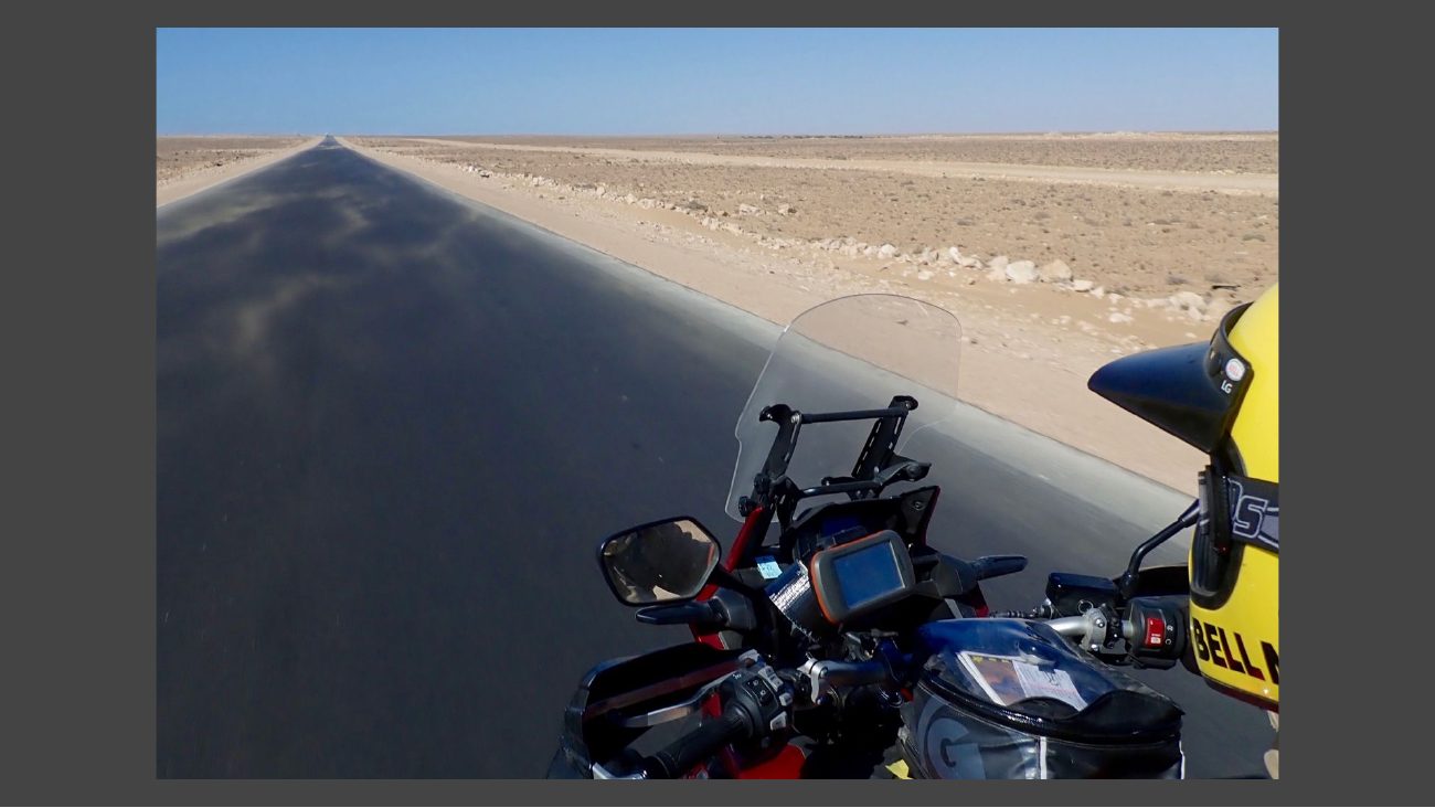
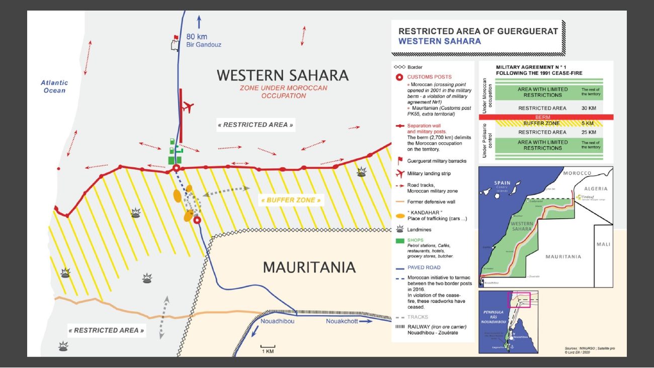
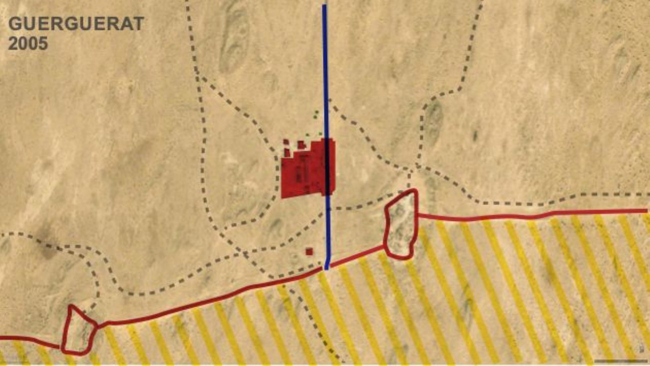
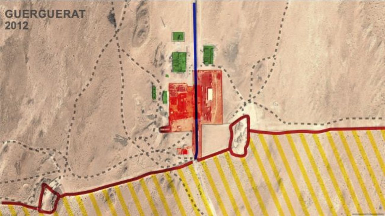
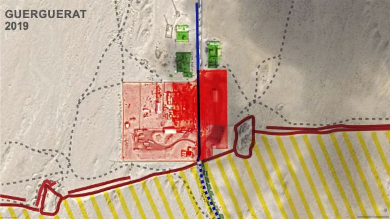
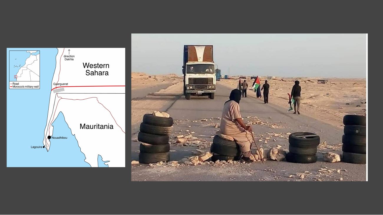
Infrastructure N1 Highway (Left) Tiznit-Dakhla Expressway (Right) N17 Highway (Left) Guerguerat Border Crossing (Right)

Slide 10

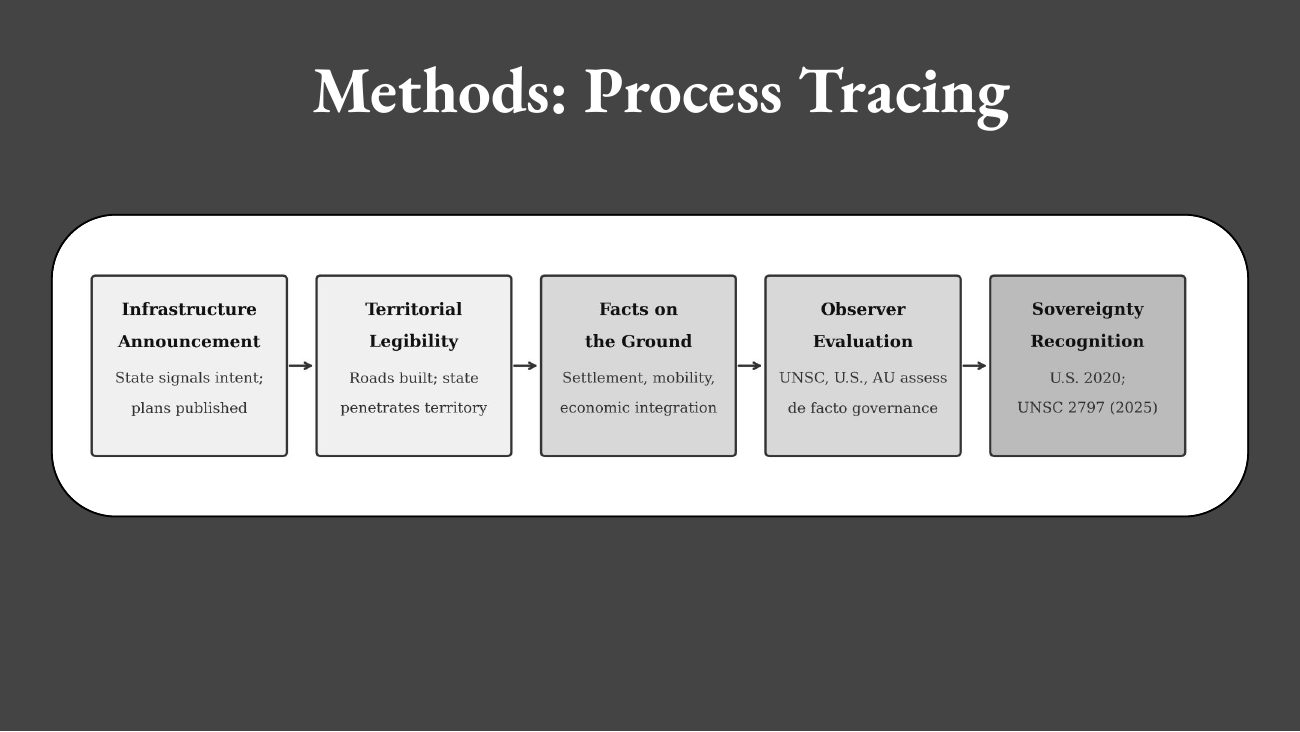
Methods: Process Tracing

Slide 11

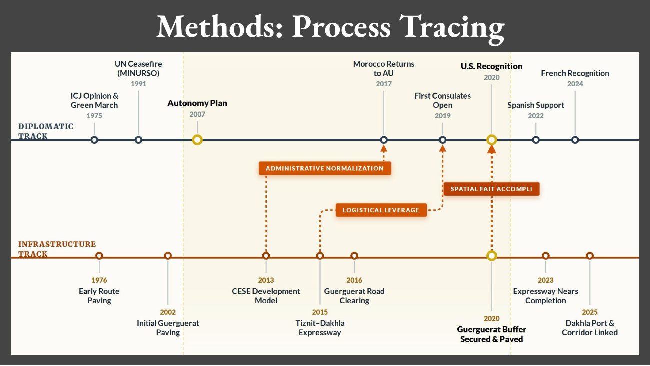
Methods: Process Tracing

Slide 12

This slide contains an image or diagram without extractable text. Open its full-size image above.

Slide 13

This slide contains an image or diagram without extractable text. Open its full-size image above.

Slide 14

This slide contains an image or diagram without extractable text. Open its full-size image above.

Slide 15

This slide contains an image or diagram without extractable text. Open its full-size image above.

Slide 16

This slide contains an image or diagram without extractable text. Open its full-size image above.

Slide 17

This slide contains an image or diagram without extractable text. Open its full-size image above.

Slide 18

This slide contains an image or diagram without extractable text. Open its full-size image above.

Slide 19

This slide contains an image or diagram without extractable text. Open its full-size image above.

Slide 20

This slide contains an image or diagram without extractable text. Open its full-size image above.

Slide 21

This slide contains an image or diagram without extractable text. Open its full-size image above.

Slide 22

How Highways Decided Morocco’s Victory in the Western Sahara Conflict Reese Hollister - Master of International Studies (MIS) 2026 SPIA at North Carolina State University Advisors: Dr. Kristen Alff and Dr. Robert Reardon

Written paper

PDFHow Highways Decided Morocco's Victory in the Western Sahara Conflict

The full capstone paper on transport-infrastructure build-out and the normalisation of Moroccan sovereignty claims.

Overview

Most accounts of Western Sahara keep diplomatic recognition and physical infrastructure in separate stories. This project asked how those stories should be read together.

The capstone's central question was how physical integration, especially transport infrastructure, helped create the conditions under which Morocco's sovereignty claims became easier to normalize.

What to notice

The deck and figures pair diplomacy with infrastructure instead of treating them as separate stories.

A roads-over-time workflow using OSM relation R2559126 and the ohsome history API supports year-end snapshots from 2008 through 2025.
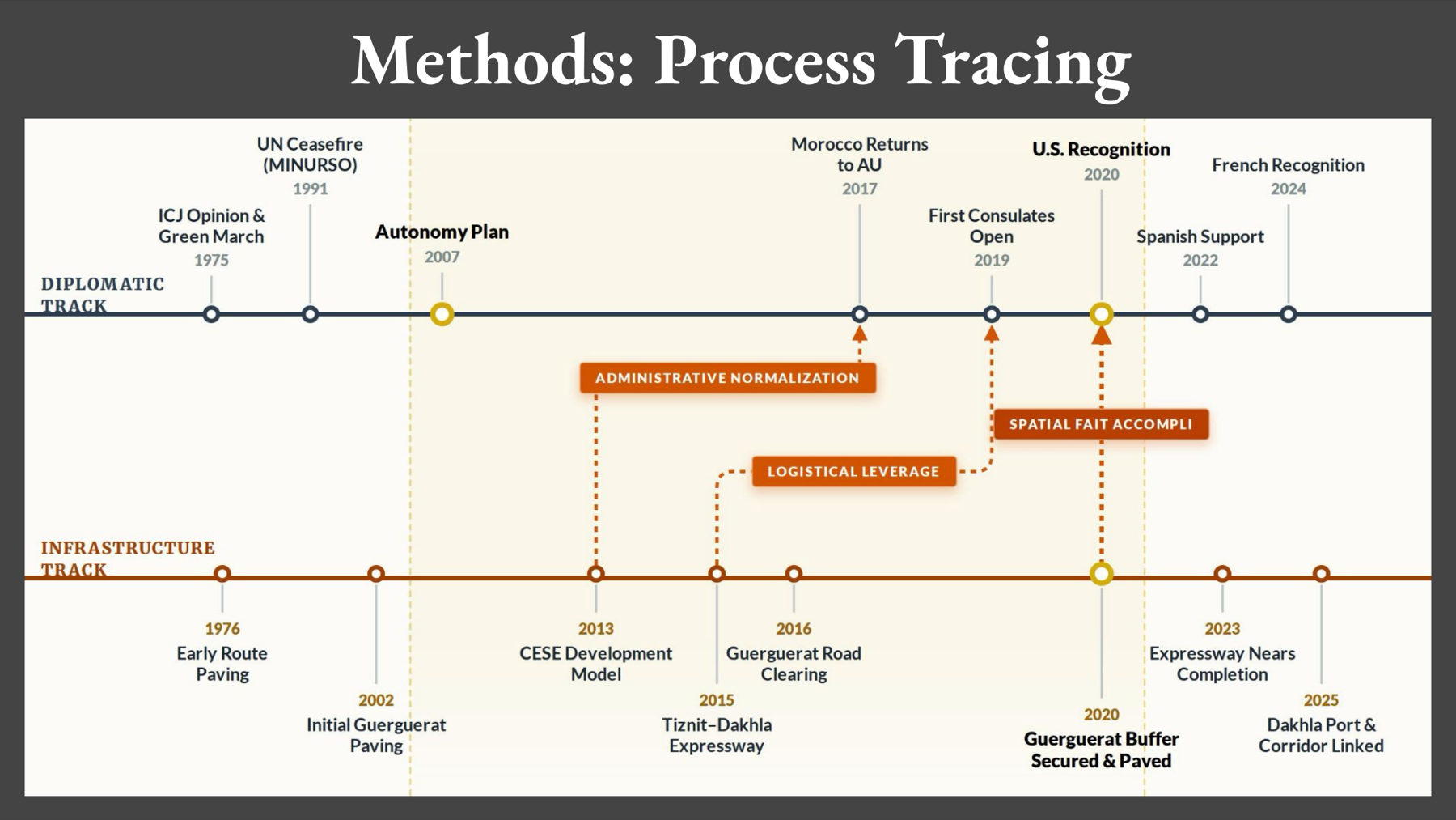
Dual-track timeline pairing a diplomatic recognition track with an infrastructure-building track from 1975 to 2025.View detail ↗
Signature figure The core analytical graphic: diplomatic milestones (top) read against infrastructure milestones (bottom), with the mechanisms — logistical leverage, administrative normalization, spatial fait accompli — that connect them.
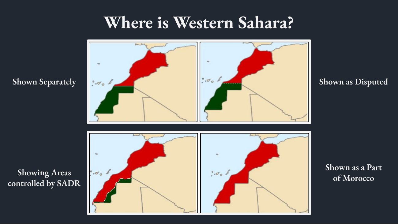
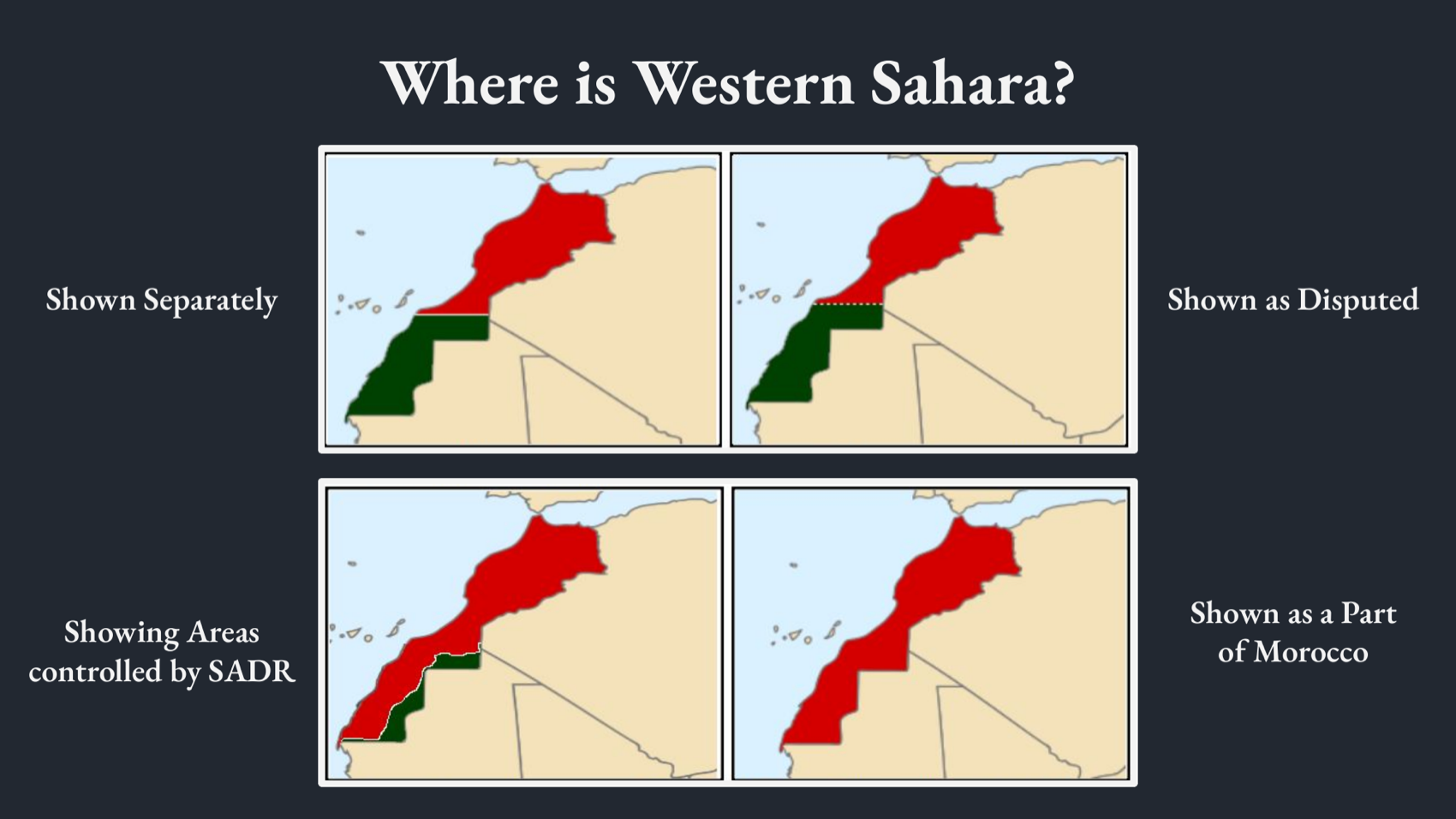
Four maps of Morocco and Western Sahara showing how the territory is variously rendered: separate, disputed, SADR-controlled, or part of Morocco.View detail ↗
Visual / artifact Four cartographic framings of the same territory — a reminder that the map itself is a contested claim.

Why it matters

The capstone produced more than a claim. It yielded a reusable evidence set, visual narrative, roads-over-time workflow, and a clearer mechanism for explaining why sovereignty politics cannot be separated from circulation.

Image detail

Open original ↗